| Correlation of 1920 Enumeration Districts to 1930 Enumeration Districts. This is the easiest way to get right to the correct 1930 ED. If the person you are searching for lived in the same place in both the 1920 and 1930 census enumeration (and know the 1920 ED) then just use this table to find the 1930 ED. | |||||||||||||||||||||||||||||||||||||||||||||||||||||||||||||||||||||||||
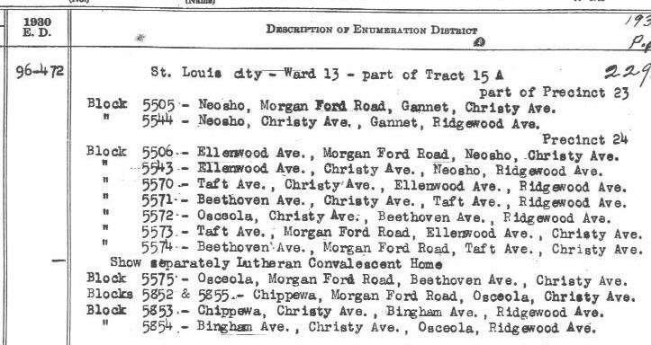
| Using copies of the 290 page detail description of the Enumeration Districts of St. Louis City lead to this finding aid. Click here for example of detail. To aid in the identification of the appropriate EDs referred to in the above description, Dr. Joel Weintraub has compiled the entire "EDs to Streets" listing (585 Enumeration Districts within the City of St. Louis). I've modified his work (slightly) by putting it into matrix form. Click here for "City Street names to 1930 EDs". Note: this finding aid covers the City only. | |||||||||||||||||||||||||||||||||||||||||||||||||||||||||||||||||||||||||
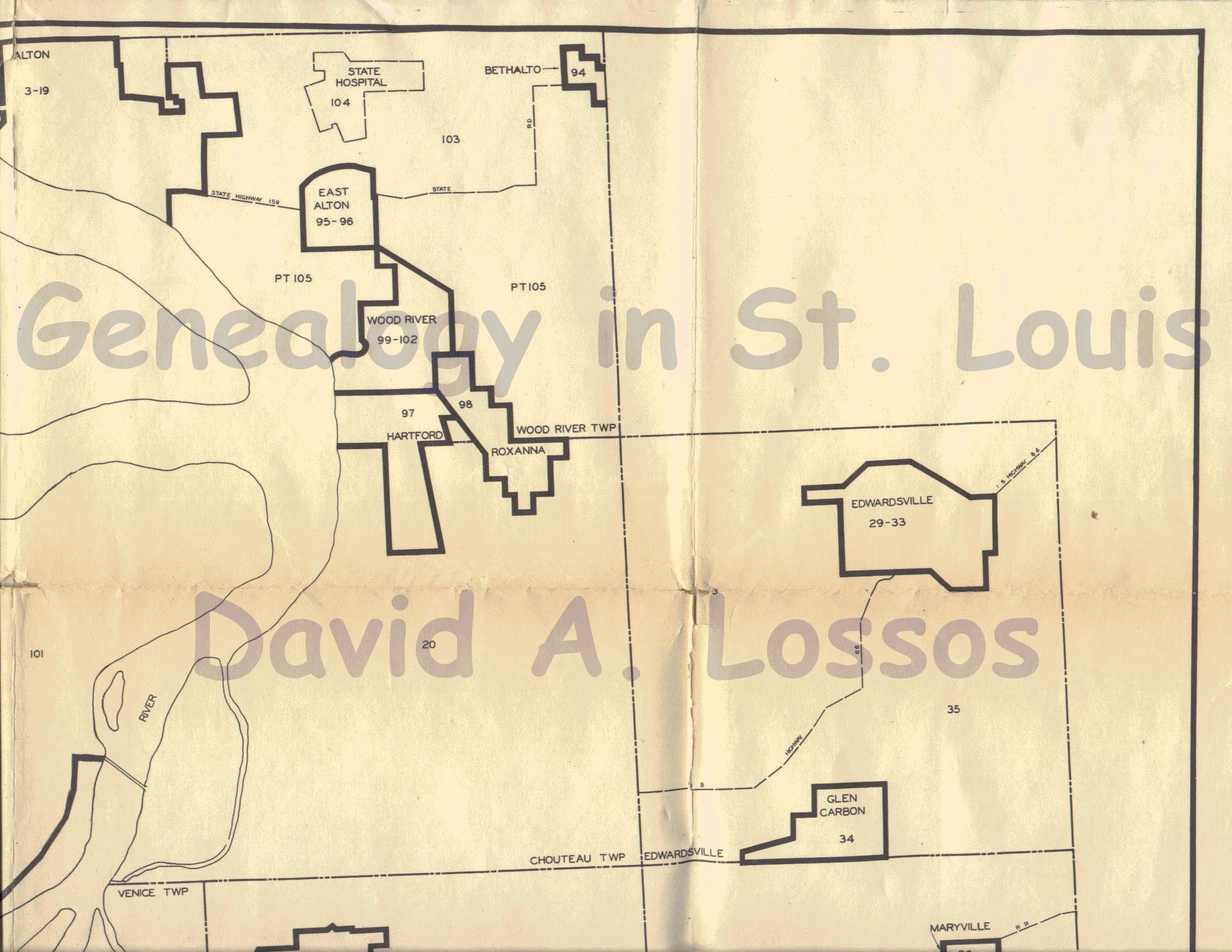
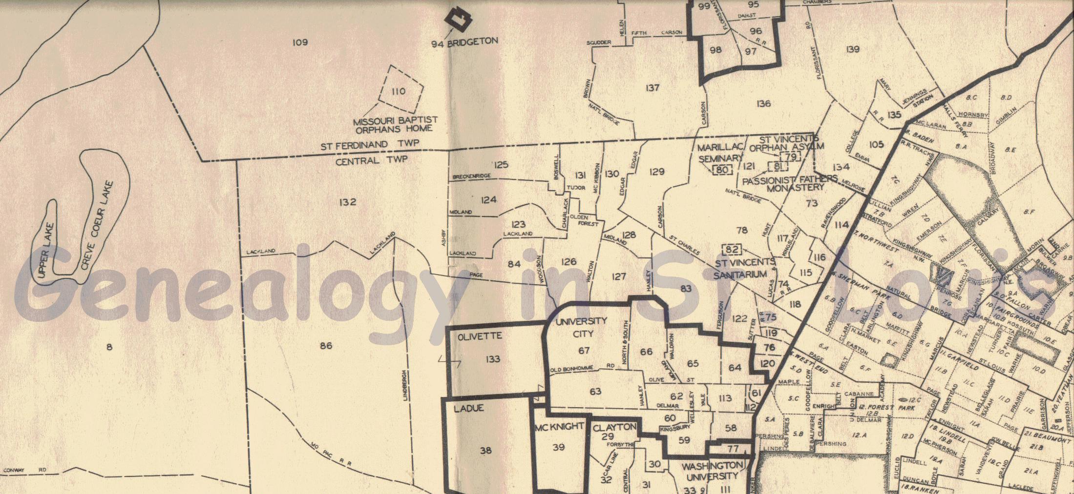
| I've added basically the same thing for St. Louis County, and also included Township and population within each of the 144 EDs. I have transcribed the 56 page detail description of the Enumeration Districts of St. Louis County. Click here for "County Boundaries to 1930 EDs". | |||||||||||||||||||||||||||||||||||||||||||||||||||||||||||||||||||||||||
| I also have copies of the 137 page detail tabulation of the Enumeration Districts of St. Louis Metropolitan Area (including St. Louis City, St. Louis County, Madison County (IL), and St. Clair County (IL). If you need this info please let me know. | |||||||||||||||||||||||||||||||||||||||||||||||||||||||||||||||||||||||||
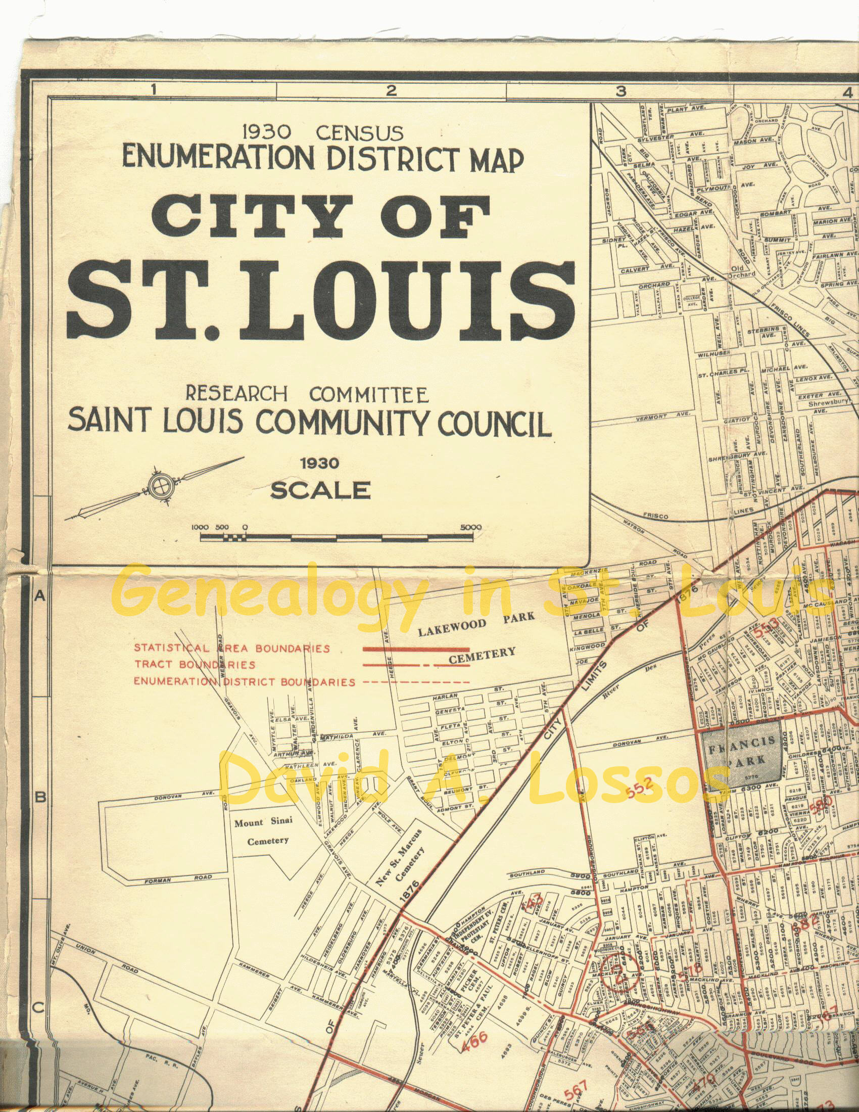
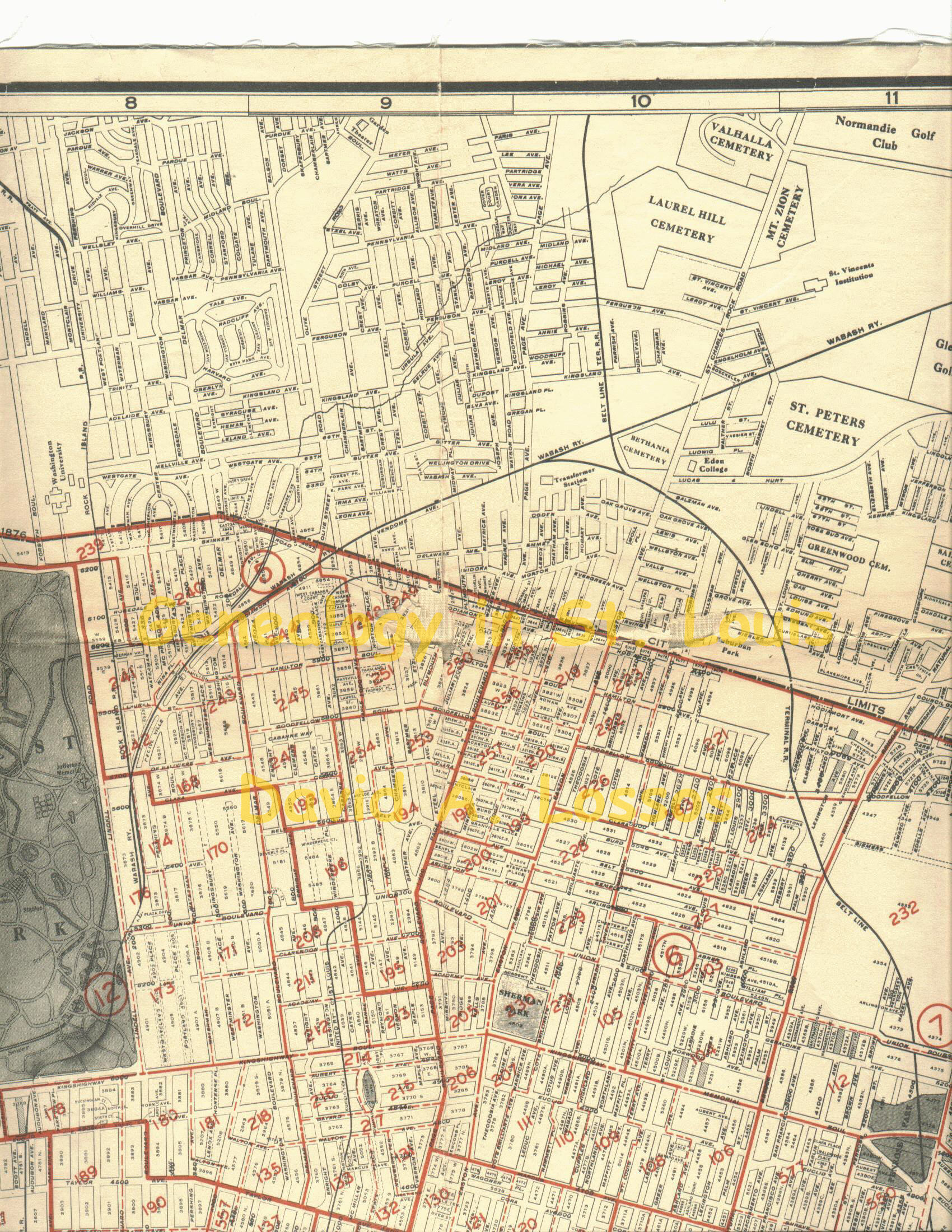
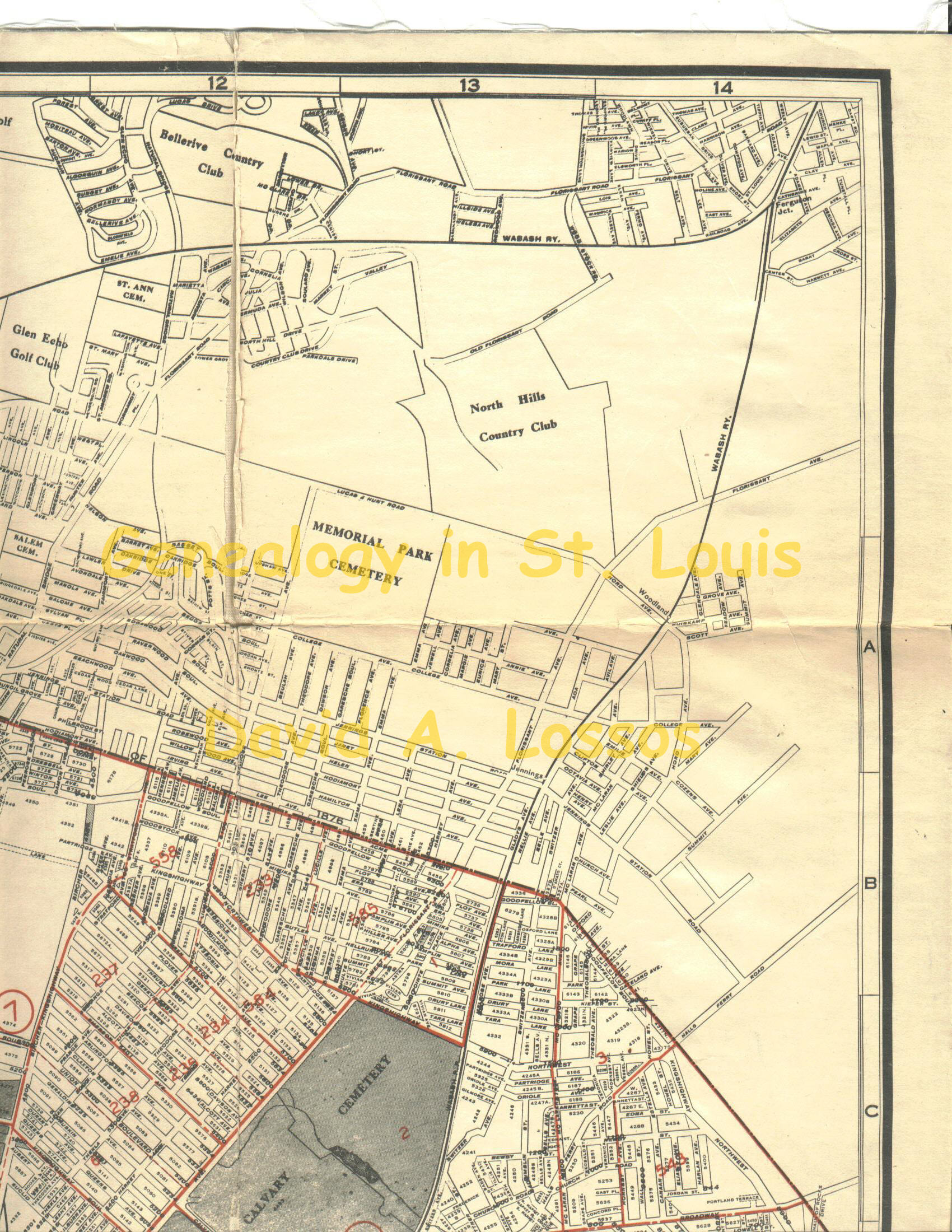
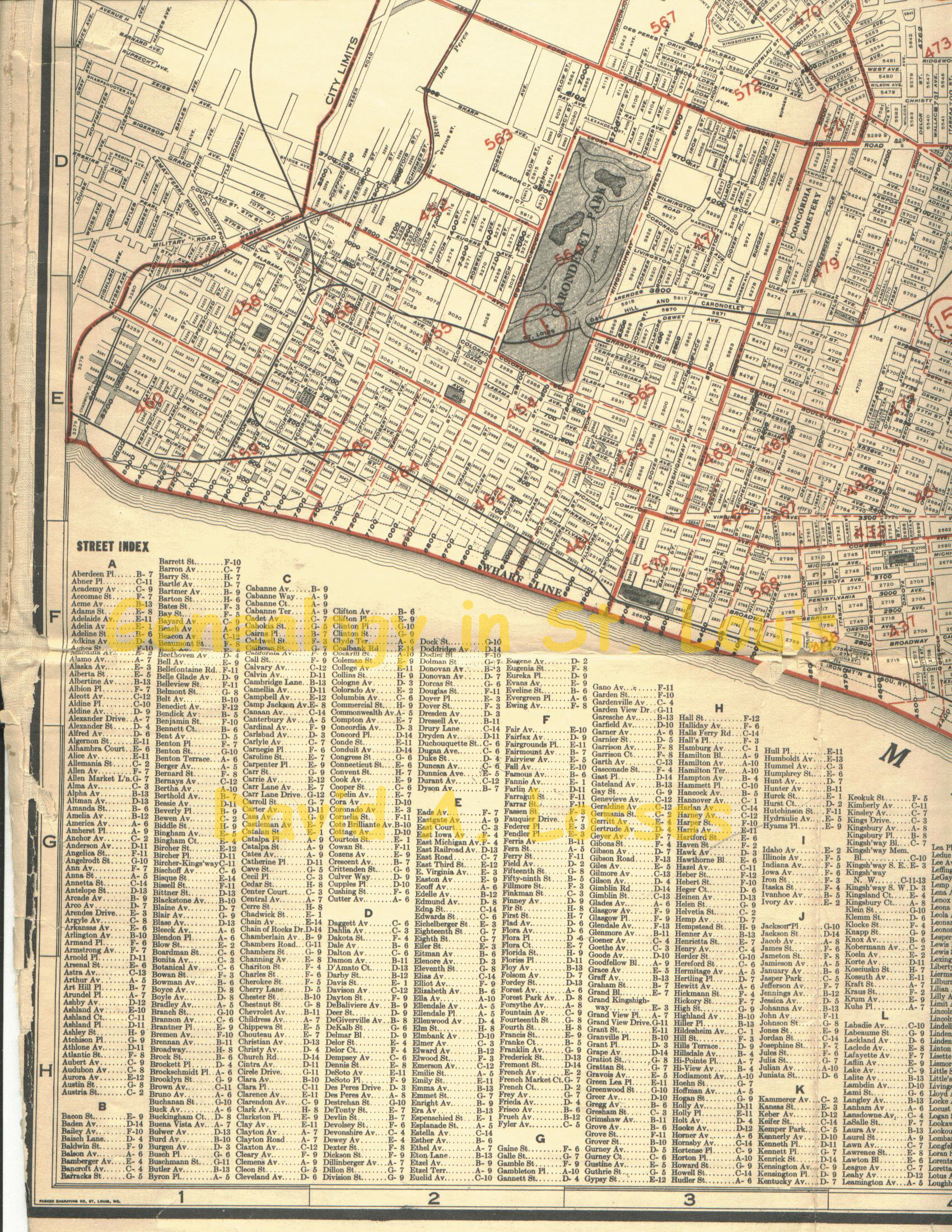
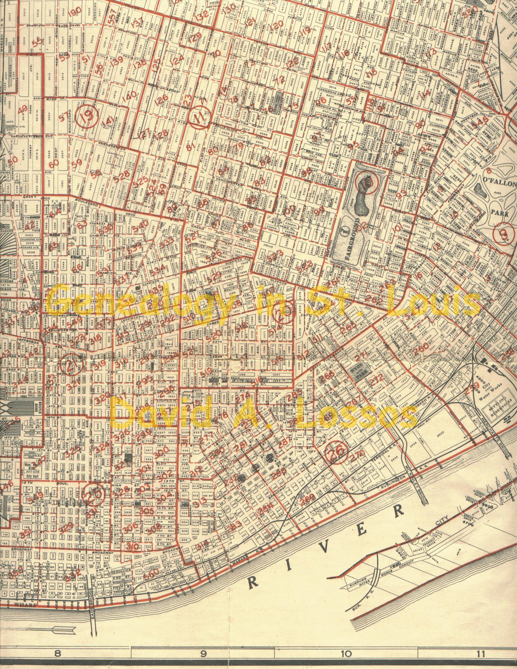
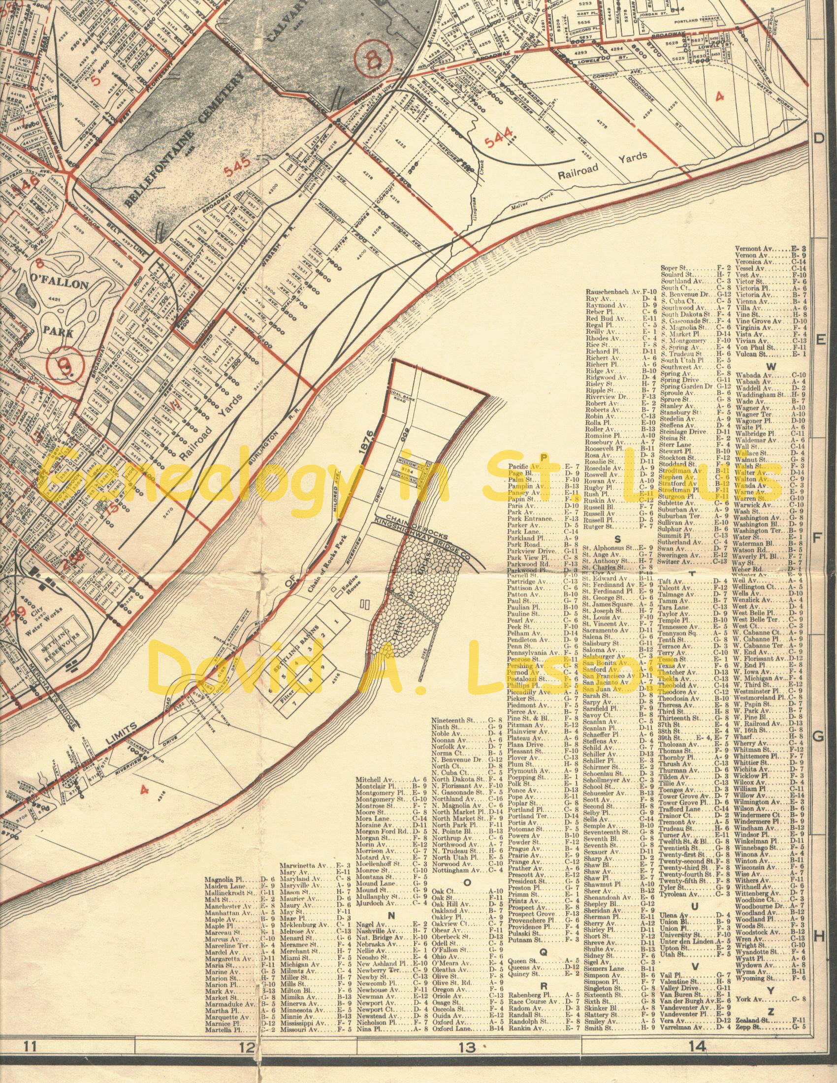
I've place the detail Enumeration District Map of the City of St. Louis (showing tract boundaries). To make life a little easier, you can click here for 1930 Street Index. NOTE: These files are HUGE because I needed to make them legible enough to read street names. If you think you are going to use these maps frequently I'd suggest you save each section to your fixed disk to save download time (and bandwidth usage).
|
|||||||||||||||||||||||||||||||||||||||||||||||||||||||||||||||||||||||||
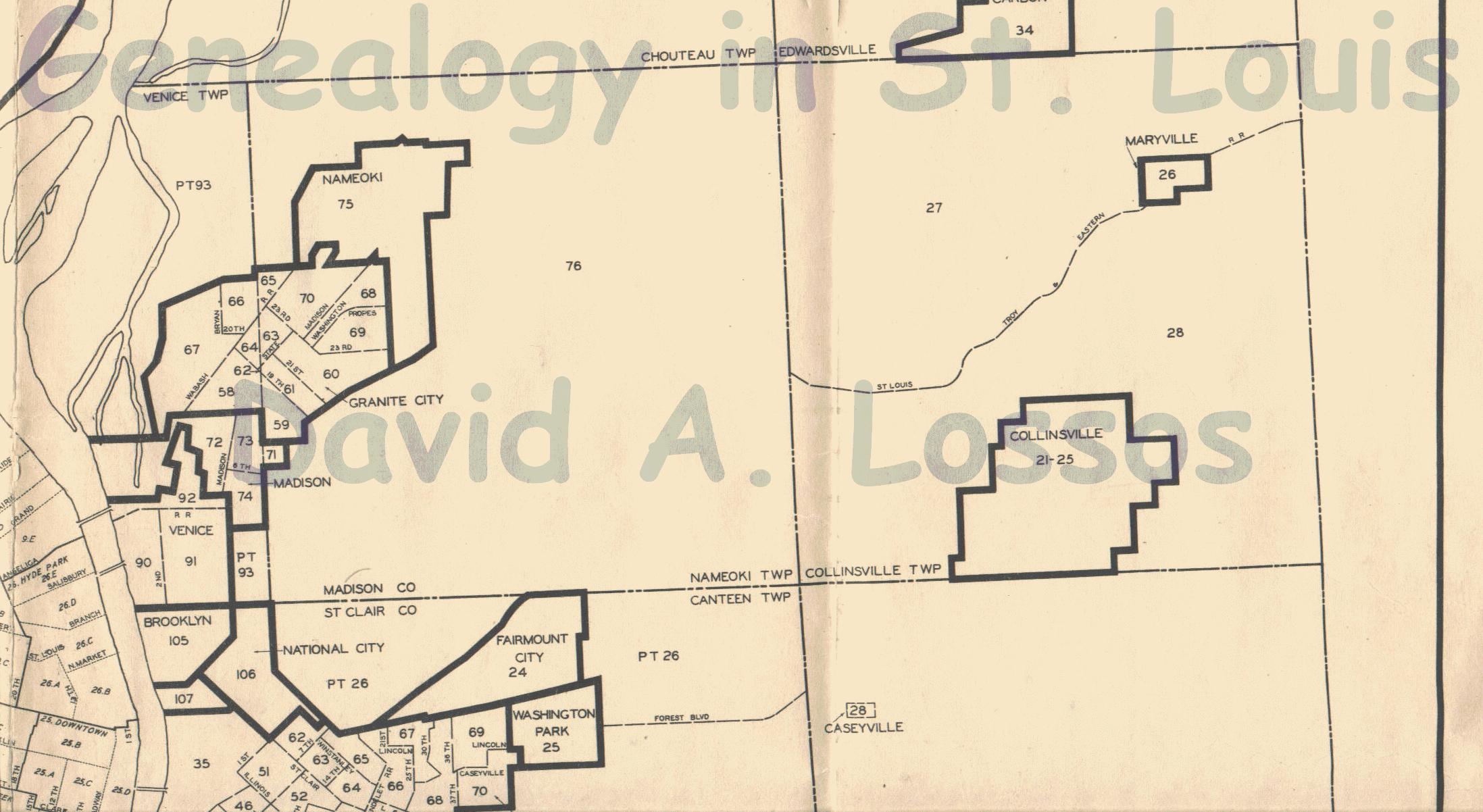
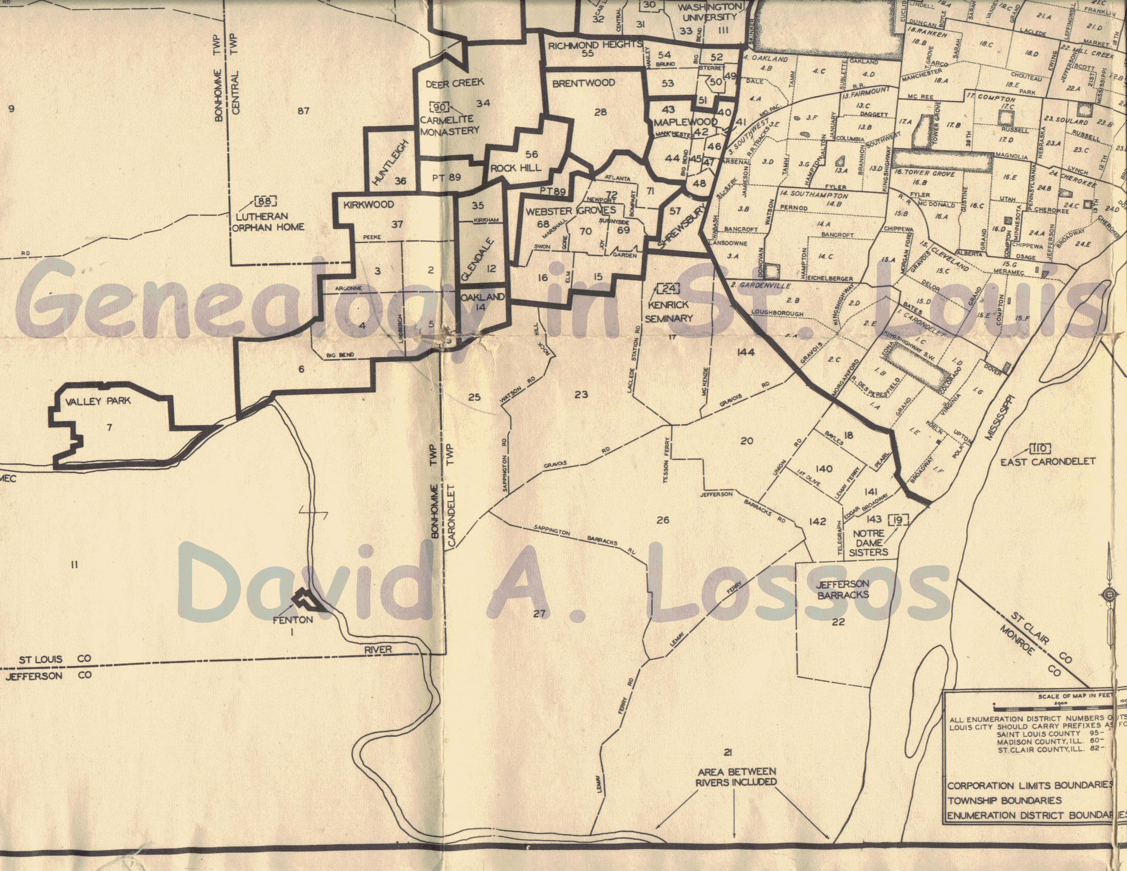
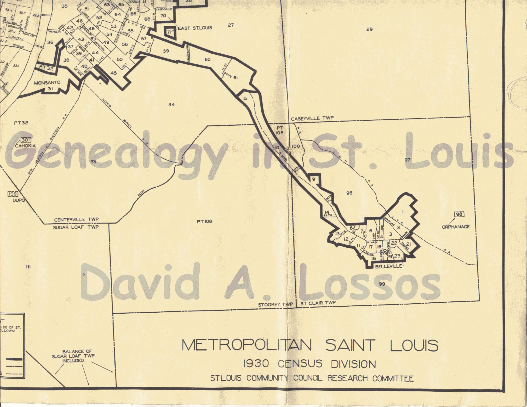
Here is a detail Census Map of the City and County of St. Louis, and the Counties of Madison and St. Clair in Illinois. In most case you can simply view the map to determine the ED of the various areas.
After you've found the folks you're looking for I hope you'll consider transcribing one or more of the many orphanages, old age homes, hospitals, etc. Click here for the 1930 Volunteer Transcription Project. Click here for a blank 1930 census form (in PDF format) to use in your transcriptions. The following table gives the Population of the 10 Largest United States Urban Places: 1930
* NOTE: Although this numerical data is defined as population of "Urban Places" the St. Louis figure is for the City of St. Louis only (by comparison, in the year 2000 Census, this same land area had a population of only 348,189). St. Louis County had an additional 1930 population of 211,610, broken down into the following Townships:
The 1930 Census enumerators asked a total of 31 questions. Send your comments to Dave Lossos To return to the "Genealogy in St. Louis" Web Site click here. When you use a TOMS Promo Code, TOMS will donate a pair of shoes to a child in need. |


