To return to the "Genealogy in St. Louis" Web Site click here.
Send your comments to Dave Lossos
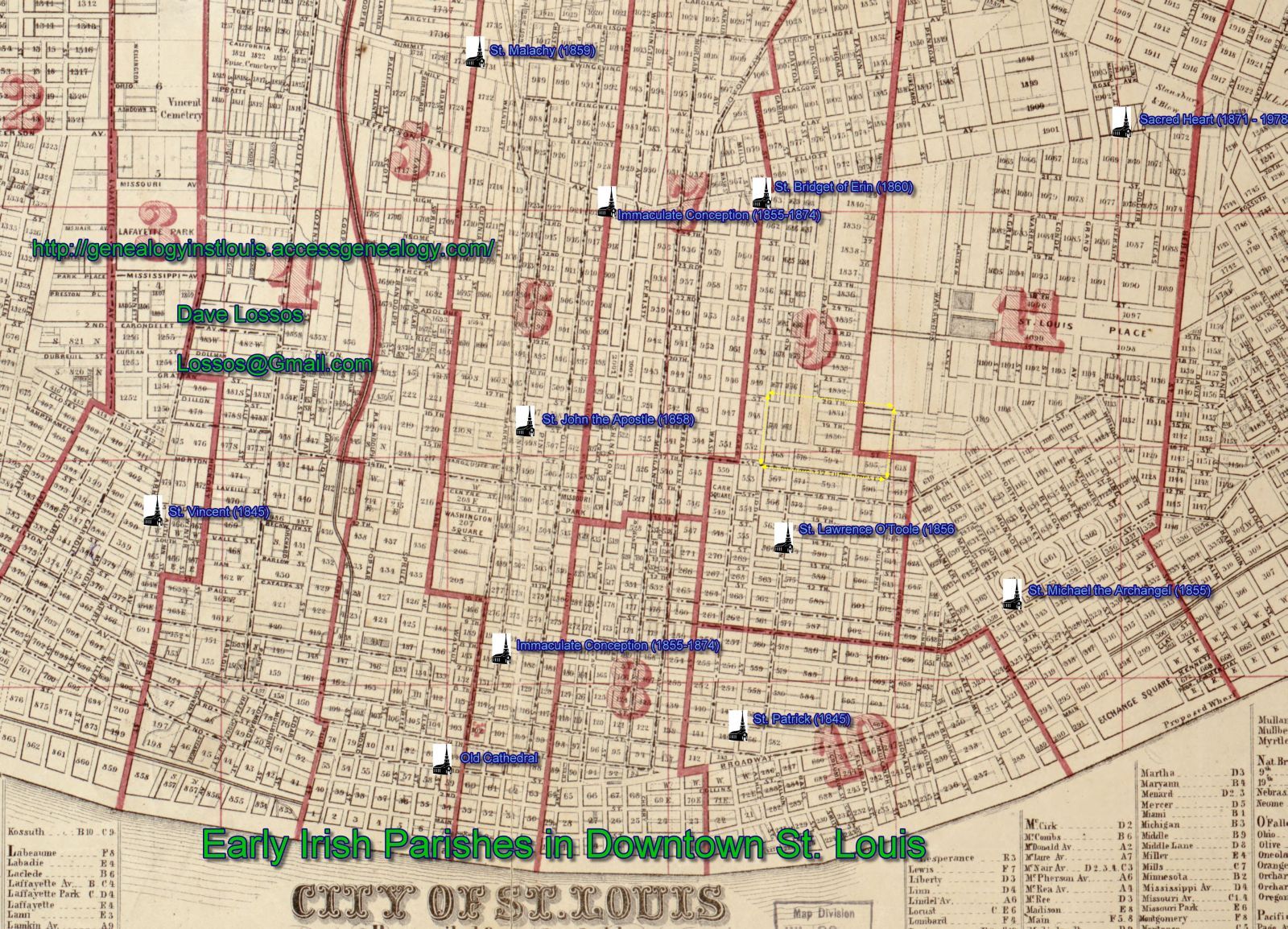
This is a map I created using the 1870 Ward map of the City of St. Louis. On it you will see the location of all the parishes within the St. Louis city that were formed up to that time with a predominant Irish congregation. I've also listed the date the parish open (and in some cases when they closed). Use your default graphics program to enlarge the image until you can clearly read the section of interest.