Pictorial St. Louis 1875
Index to "Pictorial St. Louis 1875"
Copyright David A. Lossos ©2000 - All Rights Reserved
Send comments to ōDave Lossosö
To return to the "Genealogy in St. Louis" Web Site click here.
(Updated added June 13, 2011) Using modern digital panorama software, Ben Kruenen has created a way to view the entire 110-plate Camille Dry Perspective Map, at once (see link at bottom). Terry Corbet has developed software that adds an 'electronic legend' facility on top of that view. Researchers can simply 'click' on over 400 legend items and the image will be zoomed in to provide a high resolution display of that building or location; then, using the keyboard arrow keys, they can slowly pan up and down the streets all the way from the Eads Bridge to Mr. Shaw's Arboreum. Users may add their own points of interest along with their own voice annotations to pass along additional history to the next generation. Contact Terry Corbet ([email protected]) for the free sofware for your Windows or Mac PC.
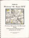
The book entitled Pictorial St. Louis - The Great Metropolis of the Mississippi Valley - A Topographical Survey drawn in perspective A. D. 1875 by Camille N. Dry is both a brilliant, artistic feat and a baffling definition of "Who's Who" in St. Louis in the year 1875. As to whether your ancestors are listed or not seems based largely on what profession they were in, or their social status. Schools and churches are richly identified, yet cemeteries are seldom noted.
This book is actually two books within one. Besides the pictorial views, noted as "Plates" (of which there are 110), there are also verbose descriptions on many of the persons and places listed on the "Plates". These show up on the "Pages"(of which there are 215). There is an index of sorts that puts the "Plates" and "Pages" items into various categories such as Churches, Lawyers, etc.
I started this project with the intention of simply indexing all of the names and places listed on the "Plates". This yielded 2128 items. I quickly realized that for this to be a valid index I needed to go back and add additional entries for many of these items. For example, items such as
Atlantic Mills Flour, Bain & Pegram, Prop'rs.
were expanded to include two more entries
Bain SEE Atlantic Mills Flour, Bain & Pegram, Prop'rs.
Pegram SEE Atlantic Mills Flour, Bain & Pegram, Prop'rs.
so that, when sorted, the index would have three lines associated with this single entry. Having done this the index had grown to 2695 line entries.
The next phase of the process was to re-key the "Index" given in the book. The reason for this is that not every item/person listed appears on both a "Plate" and a "Page". During this process I noted a number of errors and omissions with this index.
The last step entailed going through and transcribing just about every name and place listed on the "Pages". For example, on the page that discusses "Washington University" there are a dozen or more names given within the text that are not noted on either the "Plates" or the "Pages".
The final blending together of all of these separate lists resulted in the following compiled and sorted index of over 5400 entries.
This database is VERY large (over a half megabyte), and I've had to break it into two pieces. Be patient while they load.
Index to "Pictorial St. Louis 1875" Part I here.
Index to "Pictorial St. Louis 1875" Part II here.
Link to Library of Congress website that has individual "Plates" here.
Link to stitched map by Ben Kreunen in Melbourne, Australia here.