Images of St. Louis - "Now and Then"
©David A. Lossos, updated February 13, 2005
I'm in the initial phase of putting together another book entitled "Now and Then - St. Louit". Yeah, I know it's already been done, but not by me. My theory is you can never get enough photos of old St. Louis. The catch this time is that I'm going to include a present-day photo of exactly the same scenes from yester-year. The scenes below are indicative of what I'd like to include. If you have an old photo that you'd like to see in the book, please contact me. These don't have to be of famous groups or famous landmarks. They can be of such things a family groups in front of the Admiral back in the good old days. If you have questions you can contact me Dave Lossos.
To return to the "Genealogy in St. Louis" Web Site click here.
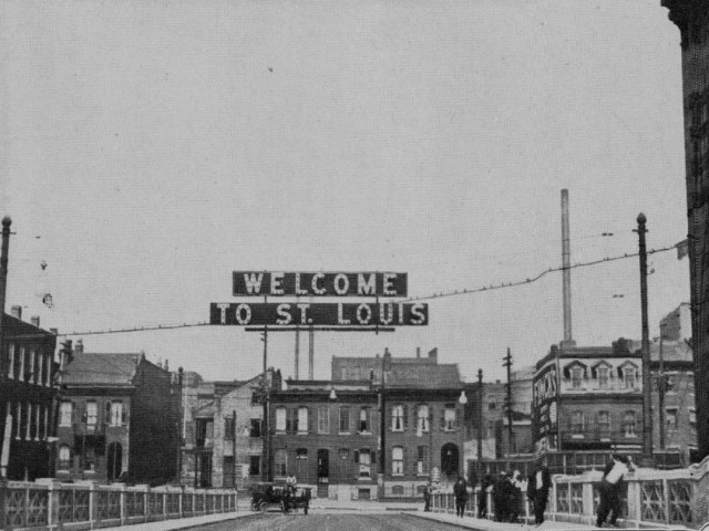
The sign above greeted travelers going west across the Municipal Free Bridge into St. Louis. This photo was taken in 1917, the year the bridge first opened.
|
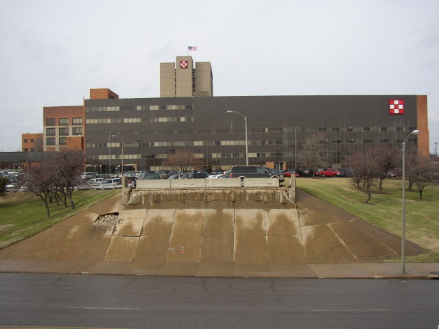
The Municipal Free Bridge was renamed the MacArthur Bridge in 1942 for the World War II general. The roadway was closed in 1981due to the cost of repairing the roadway, and the long history of cars crashing through its railings at places where the roadway makes sudden jogs. The overpass section of the east approach seen above was removed in 1989 to discourage those attempting to enter the bridge. That�s Seventh Street below. (Photo by Dave Lossos)
|
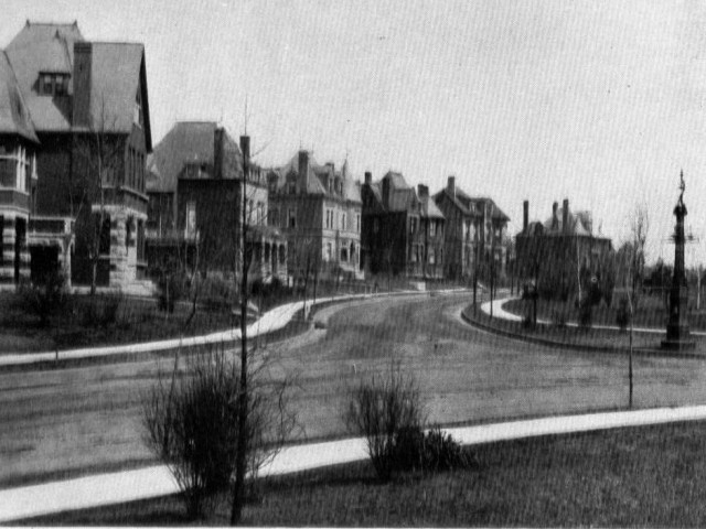
This scene of Longfellow Boulevard is just inside the Grand Avenue entrance to the neighborhood referred to as Compton Heights. The area was originally set aside by settlers for communal grazing of livestock. The land was partitioned in the 1860s and development began a few decades later. The large homes that are most notable in Compton Heights were erected in the late 1880s and early 1890s. Many of these homes were built by wealthy families of German descent.
|
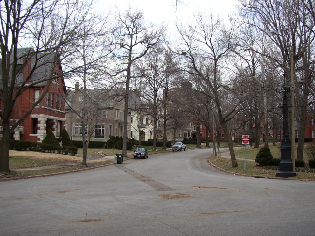
Longfellow Boulevard as it appears today. Note the large black post on the right that still stands in the same place. (Photo by Dave Lossos)
|
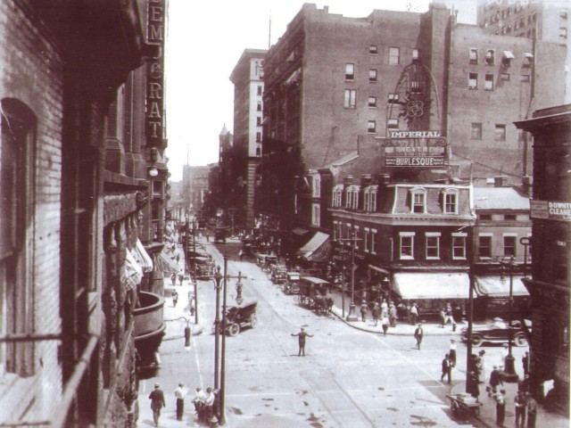
The Imperial Burlesque Theater was located on the northeast corner of 6th and Pine, as shown in this vintage photo of the busy intersection. Note the traffic policeman in the middle of the street directing traffic.
|
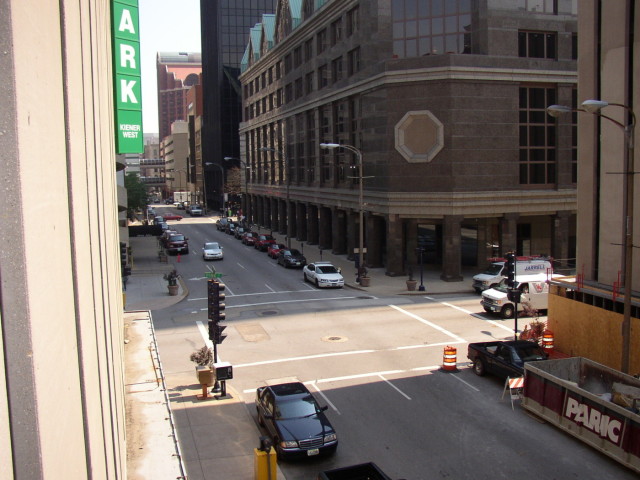
The above photo was taken hanging out of an opening in a parking garage. It captures the intersection almost identically to the photo at the top. (Photo by Dave Lossos�2004)
|
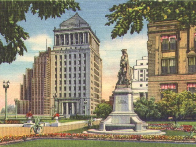
The statue of Pierre Laclede stands watch on the grounds of St. Louis City Hall. The buildings on the left are the Bell Telephone Building and the Civil Courts Building, the two tallest buildings in St. Louis at the time this postcard was made. Also seen are a corner of the Federal Courts Building, and City Hall in the foreground.
|

The exact same buildings still stand today, but are far from the tallest in the city any longer. (Photo by Dave Lossos)
|


